
Make a donation
Gear up for your next adventure:
As an Amazon Associate, this site earns from qualifying purchases at no extra cost to you.
Sotillo de la Ribera topographic map
Click on the map to display elevation.
Make a donation
Gear up for your next adventure:
As an Amazon Associate, this site earns from qualifying purchases at no extra cost to you.
About this map
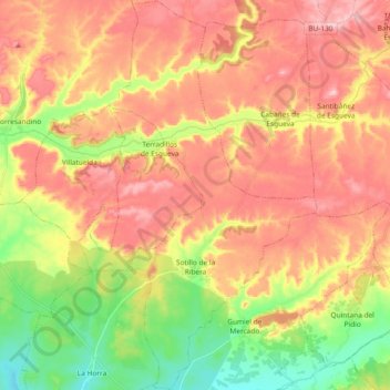
Name: Sotillo de la Ribera topographic map, elevation, terrain.
Location: Sotillo de la Ribera, Burgos, Castilla y León, 09441, España (41.73399 -3.86661 41.87265 -3.76782)
Average elevation: 2,910 ft
Minimum elevation: 2,589 ft
Maximum elevation: 3,186 ft
Make a donation
Gear up for your next adventure:
As an Amazon Associate, this site earns from qualifying purchases at no extra cost to you.
Other topographic maps
Click on a map to view its topography, its elevation and its terrain.
Make a donation
Gear up for your next adventure:
As an Amazon Associate, this site earns from qualifying purchases at no extra cost to you.
Pico Zapatero
España > Castilla y León > Sotalbo
La topografía de la Sierra de la Paramera es fundamentalmente plana, de cumbres alomadas, menos en el sector culminante, donde varios picos superan los 2000 m.
Average elevation: 5,846 ft
Make a donation
Gear up for your next adventure:
As an Amazon Associate, this site earns from qualifying purchases at no extra cost to you.
Make a donation
Gear up for your next adventure:
As an Amazon Associate, this site earns from qualifying purchases at no extra cost to you.
Make a donation
Gear up for your next adventure:
As an Amazon Associate, this site earns from qualifying purchases at no extra cost to you.
Quintanarraya
España > Castilla y León > Quintanarraya
La zona se encuentra en el margen sudoriental de la cuenca del Duero y limita al noreste con el macizo Cameros-Demanda, perteneciente al Sistema Ibérico. Su orografía se caracteriza por un relieve alomado, de formas suaves, con paisaje de campiña; junto a este, son destacables los páramos, de formas…
Average elevation: 3,110 ft
Make a donation
Gear up for your next adventure:
As an Amazon Associate, this site earns from qualifying purchases at no extra cost to you.
Maello
España > Castilla y León > Maello > Maello
El municipio está situado en la parte nororiental de la provincia en el límite con la de Segovia. Por su término pasa la autopista AP-6, a la altura del kilómetro 91. Dista 40 kilómetros de la capital de la provincia. A sus lados, se encuentran las localidades segovianas de Villacastín y Labajos, así…
Average elevation: 3,517 ft
Make a donation
Gear up for your next adventure:
As an Amazon Associate, this site earns from qualifying purchases at no extra cost to you.
Make a donation
Gear up for your next adventure:
As an Amazon Associate, this site earns from qualifying purchases at no extra cost to you.
Make a donation
Gear up for your next adventure:
As an Amazon Associate, this site earns from qualifying purchases at no extra cost to you.
Puerto de Guadarrama o Alto del León
España > Castilla y León > El Espinar
Este puerto tiene una altitud de 1511 metros en la carretera nacional 6. Está entre la localidad de San Rafael (en la vertiente segoviana) y la de Guadarrama (en la vertiente madrileña), y orográficamente entre los picos de Cabeza Líjar (1824 m) y La Peñota (1945 m), en la ladera sur del Cerro de la…
Average elevation: 4,649 ft
Make a donation
Gear up for your next adventure:
As an Amazon Associate, this site earns from qualifying purchases at no extra cost to you.
Castro Valnera
España > Castilla y León > Espinosa de los Monteros
Castro Valnera es una montaña de la cordillera Cantábrica, en el límite entre las provincias españolas de Burgos y Cantabria. Tiene una altitud de 1718 metros sobre el nivel del mar.
Average elevation: 4,278 ft
Make a donation
Gear up for your next adventure:
As an Amazon Associate, this site earns from qualifying purchases at no extra cost to you.
Quintanilla del Agua
España > Castilla y León > Quintanilla del Agua y Tordueles
Average elevation: 2,887 ft
Carracedo del Monasterio
España > Castilla y León > El Bierzo > Carracedelo
Average elevation: 1,542 ft
Make a donation
Gear up for your next adventure:
As an Amazon Associate, this site earns from qualifying purchases at no extra cost to you.
Make a donation
Gear up for your next adventure:
As an Amazon Associate, this site earns from qualifying purchases at no extra cost to you.
Make a donation
Gear up for your next adventure:
As an Amazon Associate, this site earns from qualifying purchases at no extra cost to you.
Sierra de Gata
Estos picos son cruzados por varios puertos, que son el paso natural entre ambas mesetas: puerto Viejo (1100 m), puerto de San Martín (pto. Santa Clara, 1020 m), puerto de Perales (910 m) y puerto Nuevo (950 m). La pendiente más pronunciada de estos puertos está en la cara sur, ya que la altitud media de la…
Average elevation: 2,618 ft
Parque Natural del Cañón del Río Lobos
Morfológicamente se trata de un profundo tajo excavado en las calizas del cretácico superior del cauce fluvial, que ha dejado a la vista enormes paredones de varias decenas de metros de elevación. Este tajo es fruto de una doble erosión: la debida al desgaste del propio río y la debida a la disolución de…
Average elevation: 3,560 ft
Make a donation
Gear up for your next adventure:
As an Amazon Associate, this site earns from qualifying purchases at no extra cost to you.
Make a donation
Gear up for your next adventure:
As an Amazon Associate, this site earns from qualifying purchases at no extra cost to you.
Make a donation
Gear up for your next adventure:
As an Amazon Associate, this site earns from qualifying purchases at no extra cost to you.
La Herguijuela
España > Castilla y León > San Juan de Gredos
Su altitud sobre el nivel del mar, 1602 m sobre el nivel del mar, le convierte en el segundo pueblo más alto de la provincia y de la comunidad, solamente Navasequilla, con 1648 m, le supera. Está situado, además, entre los diez más altos de España, superado por Valdelinares, Rubió, Tor, Navasequilla y Griegos.
Average elevation: 5,417 ft
Trigaza Norte o La Zapatera
España > Castilla y León > Santa Cruz del Valle Urbión
Average elevation: 5,774 ft
San Feliz de las Lavanderas
España > Castilla y León > Quintana del Castillo
Average elevation: 3,825 ft
Make a donation
Gear up for your next adventure:
As an Amazon Associate, this site earns from qualifying purchases at no extra cost to you.
Make a donation
Gear up for your next adventure:
As an Amazon Associate, this site earns from qualifying purchases at no extra cost to you.
Moncayo
España > Castilla y León > Ágreda
Otros estudios sobre distribución de las precipitaciones concluyen que se reparten con la altitud, con la isoyeta de más de 1400 mm por encima de los 2000 m s. n. m. y a partir de aquí una reducción de las precipitaciones de 119,89 mm por cada 100 metros de descenso
Average elevation: 6,411 ft
Make a donation
Gear up for your next adventure:
As an Amazon Associate, this site earns from qualifying purchases at no extra cost to you.
Make a donation
Gear up for your next adventure:
As an Amazon Associate, this site earns from qualifying purchases at no extra cost to you.
Make a donation
Gear up for your next adventure:
As an Amazon Associate, this site earns from qualifying purchases at no extra cost to you.
Make a donation
Gear up for your next adventure:
As an Amazon Associate, this site earns from qualifying purchases at no extra cost to you.
Make a donation
Gear up for your next adventure:
As an Amazon Associate, this site earns from qualifying purchases at no extra cost to you.
Sistema Central
España > Castilla y León > Candeleda
La mayor elevación del sistema es el pico Almanzor (2592 m sobre el nivel del mar), situado en la sierra de Gredos. La cordillera se subdivide en sierras separadas entre sí por grandes valles o puertos de montaña. De todas ellas, las más importantes por extensión son las siguientes, ordenadas de oeste a…
Average elevation: 7,188 ft
Castro de Sanabria
España > Castilla y León > Cobreros
Se encuentra a 1´5 km de Puebla de Sanabria (capital de la comarca de Sanabria) y a unos 900 m de altitud, por sus tierras discurren dos grandes ríos, el río Tera (afluente del río Duero) y el río Castro que recibe su nombre del pueblo y que cruza Sanabria de oeste a este y que desemboca junto al río…
Average elevation: 3,074 ft
Make a donation
Gear up for your next adventure:
As an Amazon Associate, this site earns from qualifying purchases at no extra cost to you.
Make a donation
Gear up for your next adventure:
As an Amazon Associate, this site earns from qualifying purchases at no extra cost to you.