
Bubanza topographic map
Interactive map
Click on the map to display elevation.
About this map
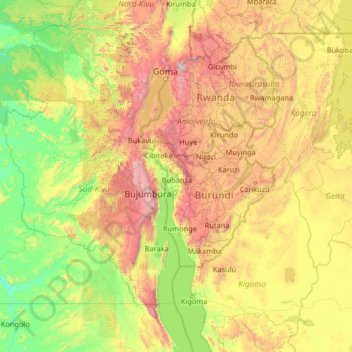
Name: Bubanza topographic map, elevation, terrain.
Location: Bubanza, Burundi (-5.71128 26.78284 -0.51128 31.98284)
Average elevation: 3,917 ft
Minimum elevation: 1,585 ft
Maximum elevation: 12,861 ft
Other topographic maps
Click on a map to view its topography, its elevation and its terrain.
Buterere
Burundi > Bujumbura Mairie > Buterere
Buterere, Bujumbura Mairie, 331, Burundi
Average elevation: 2,589 ft