
冯家岗村 topographic map
Interactive map
Click on the map to display elevation.
About this map
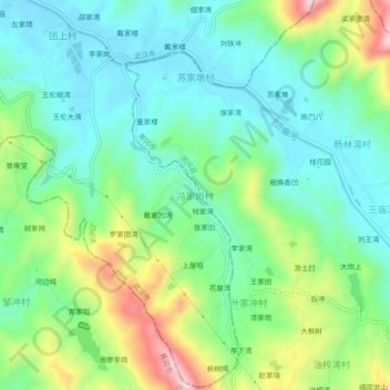
Name: 冯家岗村 topographic map, elevation, terrain.
Location: 冯家岗村, 武汉市, 湖北省, 中国 (30.77436 114.92903 30.81436 114.96903)
Average elevation: 407 ft
Minimum elevation: 118 ft
Maximum elevation: 1,073 ft
Other topographic maps
Click on a map to view its topography, its elevation and its terrain.