Geolocate

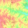
Provence topographic map

Click on the map to display elevation.

About this map

Name: Provence topographic map, elevation, terrain.

Location: Provence, Carter County, Oklahoma, United States (34.13121 -97.04085 34.17121 -97.00085)

Average elevation: 863 ft

Minimum elevation: 781 ft

Maximum elevation: 1,024 ft

Other topographic maps

Click on a map to view its topography, its elevation and its terrain.

Springer

United States > Oklahoma > Carter County

Average elevation: 850 ft

Ardmore

United States > Oklahoma > Carter County

Average elevation: 846 ft

Gene Autry

United States > Oklahoma > Carter County

Average elevation: 758 ft

Healdton

United States > Oklahoma > Carter County

Average elevation: 948 ft

Gene Autry

United States > Oklahoma > Carter County

Average elevation: 758 ft

Wilson

United States > Oklahoma > Carter County

Average elevation: 938 ft

Ardmore

United States > Oklahoma > Carter County

Average elevation: 840 ft

Lone Grove

United States > Oklahoma > Carter County

Average elevation: 899 ft

Gear up for your next adventure:

🪓Survival Multi‑Tool - Versatile tool for camp and trail tasks
🛡️Insect Repellent - Protection against bugs during outdoor activities
☕Camping Coffee Makers - Enjoy premium coffee at the summit or campsite
🥤Water Filter Bottle - All‑in‑one filter bottle for safe hydration
🔊Portable Camp Speaker - Music and alerts at camp

As an Amazon Associate, this site earns from qualifying purchases at no extra cost to you.