
猴桥镇 topographic map
Interactive map
Click on the map to display elevation.
About this map
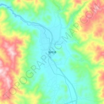
Name: 猴桥镇 topographic map, elevation, terrain.
Location: 猴桥镇, 保山市, 云南省, 中国 (25.28308 98.23781 25.36308 98.31781)
Average elevation: 6,184 ft
Minimum elevation: 5,577 ft
Maximum elevation: 7,441 ft
Other topographic maps
Click on a map to view its topography, its elevation and its terrain.