
界头镇 topographic map
Interactive map
Click on the map to display elevation.
About this map
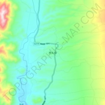
Name: 界头镇 topographic map, elevation, terrain.
Location: 界头镇, 保山市, 云南省, 中国 (25.38700 98.61463 25.46700 98.69463)
Average elevation: 5,440 ft
Minimum elevation: 4,921 ft
Maximum elevation: 6,883 ft
Other topographic maps
Click on a map to view its topography, its elevation and its terrain.