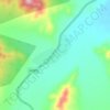
Nalaikh topographic map
Click on the map to display elevation.
About this map

Name: Nalaikh topographic map, elevation, terrain.
Location: Nalaikh, Mongolia (47.75776 107.22586 47.79970 107.29318)
Average elevation: 4,829 ft
Minimum elevation: 4,583 ft
Maximum elevation: 5,151 ft
Other topographic maps
Click on a map to view its topography, its elevation and its terrain.
Ulaanbaatar
Ulaanbaatar, formerly anglicised as Ulan Bator /ˌuːlɑːn ˈbɑːtər/ (Mongolian: Улаанбаатар, , literally "Red Hero"), is the capital and largest city of Mongolia. The city is not part of any aimag (province), and its population as of 2014 was over 1.3 million, almost half of the country's…
Average elevation: 5,098 ft

Отгонтэнгэр
Mongolia > Zavkhan > Aldarkhaan
Otgontenger (/ˌɒtɡɒnˈtɛŋɡər/; Mongolian: Отгонтэнгэр [ˈɔʰtχɞɴtʰɪŋɡɪ̆r]; lit. 'the youngest sky') is the highest peak in the Khangai Mountains of Mongolia. Its summit is calculated to reach an elevation of 4,021 meters above mean sea level. The mountain is located in Zavkhan…
Average elevation: 11,145 ft


Ulaanbaatar
Ulaanbaatar (/ʊˌlɑːn ˈbɑːtər/; Mongolian: Улаанбаатар, pronounced [ʊˌɮaːɴ‿ˈpaːʰtə̆r] , lit. 'Red Hero'), previously anglicized as Ulan Bator, is the capital and most populous city of Mongolia. It has a population of 1.6 million, and it is the coldest capital city in the world…
Average elevation: 5,039 ft


Ulaanbaatar
Ulaanbaatar (/ʊˌlɑːn ˈbɑːtər/; Mongolian: Улаанбаатар, pronounced [ʊˌɮaːɴ‿ˈpaːʰtə̆r] , lit. 'Red Hero'), previously anglicized as Ulan Bator, is the capital and most populous city of Mongolia. It has a population of 1.6 million, and it is the coldest capital city in the world…
Average elevation: 5,039 ft


Darkhan
With an elevation of 665 metres or 2,182 feet, Darkhan is the capital of the Darkhan-Uul Province. It is a city with notable Soviet influence, evidenced by the huge square buildings and heavy Cyrillic usage. Darkhan is surrounded by mountains and hills, also having some tourist attractions like statues largely…
Average elevation: 2,513 ft
Ulaanbaatar
Mongolia > Ulaanbaatar > Ulaanbaatar
Ulaanbaatar (/ˌuːlɑːn ˈbɑːtər/; Mongolian: Улаанбаатар, , lit. "Red Hero"), previously anglicized as Ulan Bator, is the capital and most populous city of Mongolia. The municipality is located in north central Mongolia at an elevation of about 1,300 metres (4,300 ft) in a valley on the Tuul…
Average elevation: 5,056 ft

Dalanzadgad
Dalanzadgad (Mongolian: Даланзадгад [táɮənt͡sətqət]) is the capital of Ömnögovi Province, Mongolia. It is located 540 kilometers (340 mi) south of the national capital Ulaanbaatar. The altitude of the city center is 1,470 metres (4,823 ft).
Average elevation: 5,089 ft




Отгонтэнгэр
Mongolia > Zavkhan > Aldarkhaan
Otgontenger (/ˌɒtɡɒnˈtɛŋɡər/; Mongolian: Отгонтэнгэр [ˈɔʰtχɞɴtʰɪŋɡɪ̆r]; lit. 'The Youngest Sky') is the highest peak in the Khangai Mountains in Mongolia. Its summit is currently calculated to reach an elevation of 4,010 meters above mean sea level (some earlier topographic…
Average elevation: 11,145 ft

Overlooking the steppe and sand dunes
Mongolia > Ömnögovi > Sevrey > Sevrey
Average elevation: 5,892 ft

Ulaanbaatar
Ulaanbaatar (/ˌuːlɑːn ˈbɑːtər/; Mongolian: Улаанбаатар, pronounced [ʊˌɮaːn‿ˈbaːʰtə̆r] , lit. "Red Hero"), previously anglicized as Ulan Bator, is the capital and most populous city of Mongolia. With a population of 1.6 million, it is the coldest capital city in the world by…
Average elevation: 5,039 ft




Bayan-Ölgii
The Khovd River (the longest in the western Mongolian Great Lakes Depression) has its origin in this aimag. It is fed by the three lakes Khoton, Khurgan, and Dayan, and in turn feeds the lake Khar-Us in the Khovd Aimag. The Tolbo Lake is a large saline lake about 50 km south of the aimag capital. It features…
Average elevation: 6,604 ft






Ulaangom
Ulaangom experiences an extremely continental cold semi-arid climate (Köppen BSk) with long, dry, frigid winters and short, warm summers. Precipitation is very low, with an annual average of 130 millimetres or 5.12 inches. Owing to its location in a deep valley near the center of the Siberian High, Ulaangom…
Average elevation: 4,475 ft






Darkhan
With an elevation of 665 metres or 2,182 feet, Darkhan is the capital of the Darkhan-Uul Province. It is a city with notable Soviet influence, evidenced by the huge square buildings and heavy Cyrillic usage. Darkhan is surrounded by mountains and hills, also having some tourist attractions like statues largely…
Average elevation: 2,513 ft

Ulaanbaatar
Ulaanbaatar is the capital and most populous city of Mongolia. It has a population of 1.6 million, and it is the coldest capital city in the world by average yearly temperature. The municipality is located in north central Mongolia at an elevation of about 1,300 metres (4,300 ft) in a valley on the Tuul River.…
Average elevation: 5,039 ft

Ulaanbaatar
Ulaanbaatar is the capital and most populous city of Mongolia. It has a population of 1.6 million, and it is the coldest capital city in the world by average yearly temperature. The municipality is located in north central Mongolia at an elevation of about 1,300 metres (4,300 ft) in a valley on the Tuul River.…
Average elevation: 5,039 ft




Ulaanbaatar
Ulaanbaatar (/ʊˌlɑːn ˈbɑːtər/; Mongolian: Улаанбаатар, pronounced [ʊˌɮaːɴ‿ˈpaːʰtə̆r] , lit. 'Red Hero'), previously anglicized as Ulan Bator, is the capital and most populous city of Mongolia. It has a population of 1.6 million, and it is the coldest capital city in the world…
Average elevation: 5,039 ft
Ulaanbaatar
Ulaanbaatar is the capital and most populous city of Mongolia. It has a population of 1.6 million, and it is the coldest capital city in the world by average yearly temperature. The municipality is located in north central Mongolia at an elevation of about 1,300 metres (4,300 ft) in a valley on the Tuul River.…
Average elevation: 5,039 ft


Choibalsan
Choibalsan (Mongolian: Чойбалсан) is the fourth-largest city in Mongolia after Ulaanbaatar, Darkhan, and Erdenet. The name of the city was Bayan Tümen (Баян Түмэн) until 1941, when it was renamed after the communist leader Khorloogiin Choibalsan in honor of the 20th anniversary of the…
Average elevation: 2,543 ft


Ulaanbaatar
Ulaanbaatar is the capital and most populous city of Mongolia. It has a population of 1.67 million, and it is the coldest capital city in the world by average yearly temperature. The municipality is located in north central Mongolia at an elevation of about 1,300 metres (4,300 ft) in a valley on the Tuul…
Average elevation: 5,039 ft