
茶陵县 topographic map
Interactive map
Click on the map to display elevation.
About this map
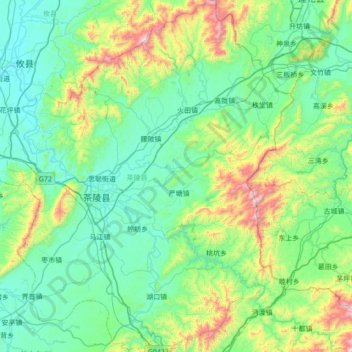
Name: 茶陵县 topographic map, elevation, terrain.
Location: 茶陵县, 株洲市, 湖南省, 中国 (26.50724 113.35041 27.12614 113.92125)
Average elevation: 1,050 ft
Minimum elevation: 217 ft
Maximum elevation: 4,521 ft
Other topographic maps
Click on a map to view its topography, its elevation and its terrain.
湘潭市雨湖区渡佳坝工程管理所
湘潭市雨湖区渡佳坝工程管理所, 烧汤河, 响塘乡, 雨湖区, 湘潭市, 湖南省, 中国
Average elevation: 154 ft