
新化县 topographic map
Interactive map
Click on the map to display elevation.
About this map
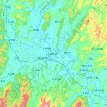
Name: 新化县 topographic map, elevation, terrain.
Location: 新化县, 娄底市, 湖南省, 417625, 中国 (27.56967 111.16190 27.88967 111.48190)
Average elevation: 1,047 ft
Minimum elevation: 512 ft
Maximum elevation: 3,825 ft
Other topographic maps
Click on a map to view its topography, its elevation and its terrain.
湘潭市雨湖区渡佳坝工程管理所
湘潭市雨湖区渡佳坝工程管理所, 烧汤河, 响塘乡, 雨湖区, 湘潭市, 湖南省, 中国
Average elevation: 154 ft