Geolocate

Franklin topographic map

Click on the map to display elevation.

About this map

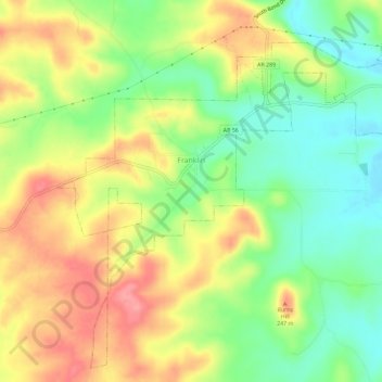
Name: Franklin topographic map, elevation, terrain.

Location: Franklin, Izard County, Arkansas, United States (36.14497 -91.79633 36.18814 -91.73866)

Average elevation: 666 ft

Minimum elevation: 515 ft

Maximum elevation: 830 ft

Izard County trails, hiking, mountain biking, running and outdoor activities

Other topographic maps

Click on a map to view its topography, its elevation and its terrain.

Sage

United States > Arkansas > Izard County

Average elevation: 735 ft

Mount Olive

United States > Arkansas > Izard County

Average elevation: 479 ft

Violet Hill

United States > Arkansas > Izard County

Average elevation: 761 ft

Dolph

United States > Arkansas > Izard County

Average elevation: 823 ft

Forty Four

United States > Arkansas > Izard County

Average elevation: 581 ft

Gid

United States > Arkansas > Izard County

Average elevation: 643 ft

Jumbo

United States > Arkansas > Izard County

Average elevation: 604 ft

Lunenburg

United States > Arkansas > Izard County

Average elevation: 525 ft

Sylamore

United States > Arkansas > Izard County

Average elevation: 531 ft

Wideman

United States > Arkansas > Izard County

Average elevation: 627 ft

Wiseman

United States > Arkansas > Izard County

Average elevation: 650 ft

Zion

United States > Arkansas > Izard County

Average elevation: 650 ft

Gear up for your next adventure:

🔦LED Headlamp - Bright and durable LED headlamp for night navigation
🏫Relief Map Kits - Hands-on tools for teaching landforms and elevation
🗺️Topographic Maps - Detailed topo maps for hiking, exploring and outdoor navigation
🧤Hiking Gloves - Protective gloves for rugged trails
📱Heavy-Duty Phone Cases - Drop-proof and waterproof protection for outdoor navigation

As an Amazon Associate, this site earns from qualifying purchases at no extra cost to you.