
下岭村 topographic map
Interactive map
Click on the map to display elevation.
About this map
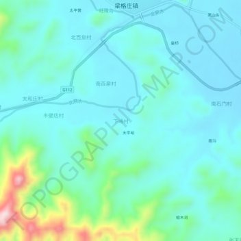
Name: 下岭村 topographic map, elevation, terrain.
Location: 下岭村, 保定市, 河北省, 中国 (39.33734 115.38334 39.37734 115.42334)
Average elevation: 413 ft
Minimum elevation: 210 ft
Maximum elevation: 1,358 ft
Other topographic maps
Click on a map to view its topography, its elevation and its terrain.