
酸枣沟村 topographic map
Interactive map
Click on the map to display elevation.
About this map
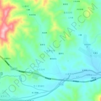
Name: 酸枣沟村 topographic map, elevation, terrain.
Location: 酸枣沟村, 保定市, 河北省, 中国 (39.32221 115.25985 39.36221 115.29985)
Average elevation: 558 ft
Minimum elevation: 367 ft
Maximum elevation: 1,119 ft
Other topographic maps
Click on a map to view its topography, its elevation and its terrain.