
民治 topographic map
Interactive map
Click on the map to display elevation.
About this map
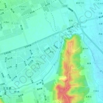
Name: 民治 topographic map, elevation, terrain.
Location: 民治, 玉龙纳西族自治县, 丽江市, 云南省, 674100, 中国 (26.82068 100.23445 26.86068 100.27445)
Average elevation: 7,818 ft
Minimum elevation: 7,762 ft
Maximum elevation: 8,002 ft
Other topographic maps
Click on a map to view its topography, its elevation and its terrain.