
Sedro-Woolley topographic map
Interactive map
Click on the map to display elevation.
About this map
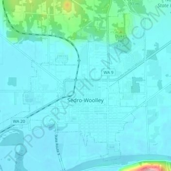
Name: Sedro-Woolley topographic map, elevation, terrain.
Location: Sedro-Woolley, Skagit County, Washington, United States (48.48928 -122.28031 48.53524 -122.20130)
Average elevation: 108 ft
Minimum elevation: 26 ft
Maximum elevation: 646 ft
Other topographic maps
Click on a map to view its topography, its elevation and its terrain.
Saddlebag Island Marine State Park
United States > Washington > Skagit County
Average elevation: 10 ft
Concrete
United States > Washington > Skagit County
Mears Field (3W5), formerly known as Concrete Municipal Airport, is located one mile south of Concrete at an elevation of 267 ft MSL.
Average elevation: 410 ft
Anacortes
United States > Washington > Skagit County > Anacortes > Anacortes
Average elevation: 121 ft
Whitmarsh Junction
United States > Washington > Skagit County > Anacortes > Whitmarsh Junction
Average elevation: 49 ft