Geolocate

Swan topographic map

Click on the map to display elevation.

About this map

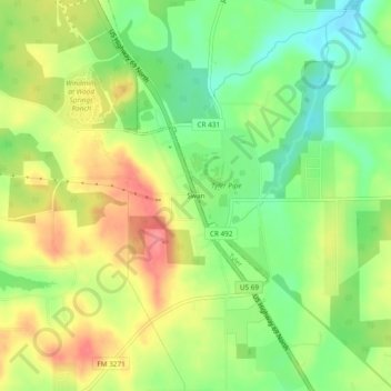
Name: Swan topographic map, elevation, terrain.

Location: Swan, Smith County, Texas, 75706, United States (32.41487 -95.38718 32.45487 -95.34718)

Average elevation: 512 ft

Minimum elevation: 390 ft

Maximum elevation: 643 ft

Smith County trails, hiking, mountain biking, running and outdoor activities

Other topographic maps

Click on a map to view its topography, its elevation and its terrain.

Tyler

United States > Texas > Smith County

Average elevation: 482 ft

Tyler

United States > Texas > Smith County

Average elevation: 482 ft

Lindale

United States > Texas > Smith County

Average elevation: 515 ft

Bullard

United States > Texas > Smith County

Average elevation: 502 ft

Hideaway

United States > Texas > Smith County

Average elevation: 512 ft

Whitehouse

United States > Texas > Smith County

Average elevation: 463 ft

Troup

United States > Texas > Smith County

Average elevation: 449 ft

Whitehouse

United States > Texas > Smith County

Average elevation: 466 ft

Tyler

United States > Texas > Smith County

Average elevation: 482 ft

Tyler

United States > Texas > Smith County

Average elevation: 482 ft

Noonday

United States > Texas > Smith County

Average elevation: 469 ft

Bullard

United States > Texas > Smith County

Average elevation: 502 ft

Tyler

United States > Texas > Smith County

Average elevation: 482 ft

Fun Forest Park

United States > Texas > Smith County > Tyler

Average elevation: 535 ft

Troup

United States > Texas > Smith County

Average elevation: 449 ft

Lindale

United States > Texas > Smith County

Average elevation: 515 ft

Lindale

United States > Texas > Smith County

Average elevation: 515 ft

Bullard

United States > Texas > Smith County

Average elevation: 502 ft

Winona

United States > Texas > Smith County

Average elevation: 377 ft

Whitehouse

United States > Texas > Smith County

Average elevation: 466 ft

Whitehouse

United States > Texas > Smith County

Average elevation: 463 ft

Tyler

United States > Texas > Smith County

Average elevation: 482 ft

Gear up for your next adventure:

🧣Hiking Neck Gaiter - Multi‑use neck protection for outdoor weather
🥇GPS Hiking Watch - Multi‑sport GPS watch with navigation and trail tracking
🪶Survival Guide Book - Expert advice for emergency preparedness
🧭GPS Watch Accessories - Bands and chargers for GPS watches
🧢Outdoor Hiking Hat - Sun protection hat for outdoor explorers

As an Amazon Associate, this site earns from qualifying purchases at no extra cost to you.