
Hudson Oaks topographic map
Click on the map to display elevation.
About this map
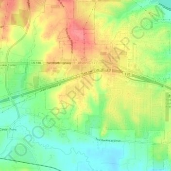
Name: Hudson Oaks topographic map, elevation, terrain.
Location: Hudson Oaks, Parker County, Texas, United States (32.73022 -97.72450 32.77254 -97.67367)
Average elevation: 978 ft
Minimum elevation: 863 ft
Maximum elevation: 1,102 ft
Parker County trails, hiking, mountain biking, running and outdoor activities
Other topographic maps
Click on a map to view its topography, its elevation and its terrain.