
捧当乡 topographic map
Interactive map
Click on the map to display elevation.
About this map
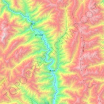
Name: 捧当乡 topographic map, elevation, terrain.
Location: 捧当乡, 贡山独龙族怒族自治县, 怒江傈僳族自治州, 云南省, 中国 (27.77490 98.58620 28.14038 98.81605)
Average elevation: 10,715 ft
Minimum elevation: 4,760 ft
Maximum elevation: 16,637 ft
Other topographic maps
Click on a map to view its topography, its elevation and its terrain.