
Maurstad topographic map
Click on the map to display elevation.
About this map
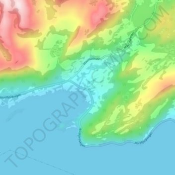
Name: Maurstad topographic map, elevation, terrain.
Location: Maurstad, Stad, Vestland, 6711, Norway (61.92048 5.44090 61.96048 5.48090)
Average elevation: 427 ft
Minimum elevation: -13 ft
Maximum elevation: 1,601 ft
Other topographic maps
Click on a map to view its topography, its elevation and its terrain.