
Sveio topographic map
Click on the map to display elevation.
About this map
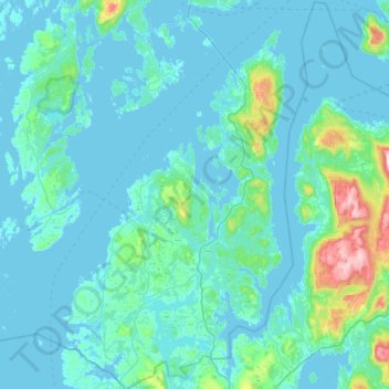
Name: Sveio topographic map, elevation, terrain.
Location: Sveio, Vestland, Norway (59.47542 5.18741 59.75463 5.58073)
Average elevation: 187 ft
Minimum elevation: -3 ft
Maximum elevation: 2,192 ft
Other topographic maps
Click on a map to view its topography, its elevation and its terrain.