
大兴地镇 topographic map
Interactive map
Click on the map to display elevation.
About this map
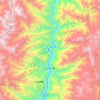
Name: 大兴地镇 topographic map, elevation, terrain.
Location: 大兴地镇, 泸水市, 怒江傈僳族自治州, 云南省, 中国 (25.96204 98.68762 26.18418 99.01026)
Average elevation: 8,071 ft
Minimum elevation: 2,694 ft
Maximum elevation: 13,402 ft
Other topographic maps
Click on a map to view its topography, its elevation and its terrain.