
Hotan Prefecture topographic map
Interactive map
Click on the map to display elevation.
About this map
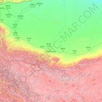
Name: Hotan Prefecture topographic map, elevation, terrain.
Location: Hotan Prefecture, Xinjiang, China (34.33406 77.39919 39.62275 84.98375)
Average elevation: 9,816 ft
Minimum elevation: 3,235 ft
Maximum elevation: 24,905 ft
Other topographic maps
Click on a map to view its topography, its elevation and its terrain.
Tian Shan
China > Xinjiang > Wensu County
Continuous permafrost is typically found in the Tian Shan starting at the elevation of about 3,500-3,700 m above the sea level. Discontinuous alpine permafrost usually occurs down to 2,700-3,300 m, but in certain locations, due to the peculiarity of the aspect and the microclimate, it can be found at…
Average elevation: 20,000 ft
Altyn-Tagh
A series of mountain ranges run along the northern edge of the Tibetan Plateau. In the west are the Kunlun Mountains. About halfway across the south side of the Tarim Basin, the Altyn-Tagh Range diverges northeast while the Kunluns continue directly east, forming a relatively narrow "V". Inside the "V" are a…
Average elevation: 19,006 ft