Asuncion topographic map
Click on the map to display elevation.
Asuncion
Another important elevation was Mount Tacumbú, but in the 1950s began its exploitation in order to pave the streets of Asunción. Today only a lagoon remains as a result of the impossibility of suctioning the waters by the rocks that were left there. The quarry stopped working due to the urbanization of the area. Its current height is 91 meters (299 ft).
About this map
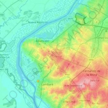
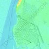
Name: Asuncion topographic map, elevation, terrain.
Location: Asuncion, Región Oriental, Paraguay (-25.38119 -57.67362 -25.21883 -57.52493)
Average elevation: 282 ft
Minimum elevation: 154 ft
Maximum elevation: 630 ft
Other topographic maps
Click on a map to view its topography, its elevation and its terrain.
Asuncion
Another important elevation was Mount Tacumbú, but in the 1950s began its exploitation in order to pave the streets of Asunción. Today only a lagoon remains as a result of the impossibility of suctioning the waters by the rocks that were left there. The quarry stopped working due to the urbanization of the…
Average elevation: 269 ft

Asuncion
Another important elevation was Mount Tacumbú, but in the 1950s began its exploitation in order to pave the streets of Asunción. Today only a lagoon remains as a result of the impossibility of suctioning the waters by the rocks that were left there. The quarry stopped working due to the urbanization of the…
Average elevation: 269 ft

Gran Chaco
Paraguay > Alto Paraguay > Bahía Negra
Large tracts of the central and northern Chaco have high soil fertility, sandy alluvial soils with elevated levels of phosphorus, and a topography that is favorable for agricultural development. Other aspects are challenging for farming: a semiarid to semihumid climate (600–1300 mm annual rainfall) with a…
Average elevation: 545 ft
Pirayú
Paraguay > Department of Paraguari > Pirayu District
The district of Pirayú is situated at the northern end of the Department of Paraguarí, in which the topography is rugged, comprising hills belonging to the Highlands range. Included among the elevations of the region are the hills Yvytypané, Mbatoví and Santo Tomás. It has an area of 141 km2 of…
Average elevation: 364 ft
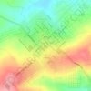
Altos
Paraguay > Cordillera Department
It is also called “Altos de Ybypytaré”, which in Guaraní means “path of the wind”, previously called “San Lorenzo de la Cordillera de los Altos”, one of the oldest cities of Paraguay. It is known as the “Terrace of the country” because of its high altitude.
Average elevation: 682 ft
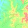
Altos
Paraguay > Cordillera Department
It is also called "Altos de Ybypytaré", which in Guaraní means "path of the wind", previously called "San Lorenzo de la Cordillera de los Altos", one of the oldest cities of Paraguay. It is known as the "Terrace of the country" because of its high altitude.
Average elevation: 682 ft




Gran Chaco
Paraguay > Alto Paraguay > Bahía Negra
Large tracts of the central and northern Chaco have high soil fertility, sandy alluvial soils with elevated levels of phosphorus, and a topography that is favorable for agricultural development. Other aspects are challenging for farming: a semiarid to semihumid climate (600–1300 mm annual rainfall) with a…
Average elevation: 545 ft