

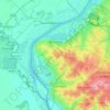
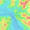
Asuncion topographic map
Click on the map to display elevation.
Asuncion
Another important elevation was Mount Tacumbú, but in the 1950s began its exploitation in order to pave the streets of Asunción. Today only a lagoon remains as a result of the impossibility of suctioning the waters by the rocks that were left there. The quarry stopped working due to the urbanization of the area. Its current height is 91 meters (299 ft).
About this map
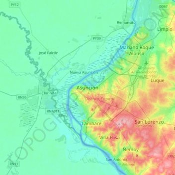
Name: Asuncion topographic map, elevation, terrain.
Average elevation: 269 ft
Minimum elevation: 161 ft
Maximum elevation: 623 ft
Other topographic maps
Click on a map to view its topography, its elevation and its terrain.
Minga Porá
It is located at an elevation of 213.54 m (700.6 ft) above sea level. The district has a tropical savanna climate (Köppen climate classification: Aw). The average annual temperature is 24.38 °C (75.88 °F). The district receives an average annual rainfall of 20.365 cm (8.018 in) and has 164.97 rainy days in…
Average elevation: 1,020 ft



Asuncion
Another important elevation was Mount Tacumbú, but in the 1950s began its exploitation in order to pave the streets of Asunción. Today only a lagoon remains as a result of the impossibility of suctioning the waters by the rocks that were left there. The quarry stopped working due to the urbanization of the…
Average elevation: 282 ft

Asuncion
Another important elevation was Mount Tacumbú, but in the 1950s began its exploitation in order to pave the streets of Asunción. Today only a lagoon remains as a result of the impossibility of suctioning the waters by the rocks that were left there. The quarry stopped working due to the urbanization of the…
Average elevation: 282 ft
Asuncion
Another important elevation was Mount Tacumbú, but in the 1950s began its exploitation in order to pave the streets of Asunción. Today only a lagoon remains as a result of the impossibility of suctioning the waters by the rocks that were left there. The quarry stopped working due to the urbanization of the…
Average elevation: 282 ft
Cordillera Department
Its elevations are the most attractive hills Caacupé and Tobatí.
Average elevation: 364 ft
Villarrica
The soils of the urban area are mainly sandy hills, with gentle slopes in the northern area and slightly steeper slopes in the south. Good drainage and no rockiness are also observed. Both in the urban area of Villarrica and in 14 de Mayo area (on the way to Ñumí) you can find ferruginous laterites and they…
Average elevation: 525 ft
Areguá
Areguá is thought to come from Classical Guarani ariguâ·r ("[person/people] from above, from up there"), refererring to the area's high altitude and its first inhabitants from the Mbya Guarani tribes.
Average elevation: 292 ft
Pirayú
Paraguay > Department of Paraguari > Pirayu District
The district of Pirayú is situated at the northern end of the Department of Paraguarí, in which the topography is rugged, comprising hills belonging to the Highlands range. Included among the elevations of the region are the hills Yvytypané, Mbatoví and Santo Tomás. It has an area of 141 km2 of…
Average elevation: 364 ft
Altos
Paraguay > Cordillera Department
It is also called “Altos de Ybypytaré”, which in Guaraní means “path of the wind”, previously called “San Lorenzo de la Cordillera de los Altos”, one of the oldest cities of Paraguay. It is known as the “Terrace of the country” because of its high altitude.
Average elevation: 682 ft
Pirayu District
Paraguay > Department of Paraguari
The district of Pirayú is situated at the northern end of the Department of Paraguarí, in which the topography is rugged, comprising hills belonging to the Highlands range. Included among the elevations of the region are the hills Yvytypané, Mbatoví and Santo Tomás. It has an area of 141 km2 of…
Average elevation: 482 ft
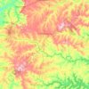
Altos
Paraguay > Cordillera Department
It is also called "Altos de Ybypytaré", which in Guaraní means "path of the wind", previously called "San Lorenzo de la Cordillera de los Altos", one of the oldest cities of Paraguay. It is known as the "Terrace of the country" because of its high altitude.
Average elevation: 682 ft
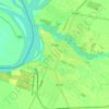
Villarrica
The soils of the urban area are mainly sandy hills, with gentle slopes in the northern area and slightly steeper slopes in the south. Good drainage and no rockiness are also observed. Both in the urban area of Villarrica and in 14 de Mayo area (on the way to Ñumí) you can find ferruginous laterites and they…
Average elevation: 525 ft
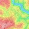

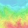
Department of Paraguari
Based on the country's capital, Asuncion, it should take Route I Mcal. Lopez, at approximately 51 km (from Asunción) is the city of Yaguarón. The capital of the department, Paraguarí, lies at an altitude of 66 meters.
Average elevation: 351 ft

Cordillera Department
Its elevations are the most attractive hills Caacupé and Tobatí.
Average elevation: 364 ft
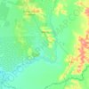

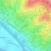
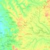
Caaguazú
The Cordillera de Caaguazú extends throughout the department from north to south. It is made up of the mountain ranges of San Joaquín, in San Joaquín and Yhú; Tajao Paú and Carayaó; and Caaguazú, between Carayaó and Coronel Oviedo. Peak heights are no more than 200 meters, but to the east elevations…
Average elevation: 745 ft

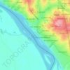
San José de los Arroyos
Although there is some controversy regarding its foundation, the official version is that it was founded by a former governor of Paraguay, Don Pedro Melo de Portugal on March 19, 1780, still during the time of Spanish colonialism and later elevated to a municipality in 1884. Like most towns in Paraguay with…
Average elevation: 397 ft

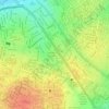
Villa Elisa
The topographic characteristics of the Central Department vary among curves of 58 to 250 meters over the sea level. Villa Elisa has sandy soil covered by vegetation.
Average elevation: 394 ft
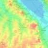
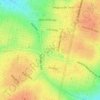
Areguá
Areguá is thought to come from Classical Guarani ariguâ·r ("[person/people] from above, from up there"), refererring to the area's high altitude and its first inhabitants from the Mbya Guarani tribes.
Average elevation: 292 ft