
临沭县 topographic map
Interactive map
Click on the map to display elevation.
About this map
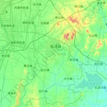
Name: 临沭县 topographic map, elevation, terrain.
Location: 临沭县, 临沂市, 山东省, 中国 (34.67986 118.43588 35.09995 118.86344)
Average elevation: 203 ft
Minimum elevation: 16 ft
Maximum elevation: 1,122 ft
Other topographic maps
Click on a map to view its topography, its elevation and its terrain.