
Make a donation
Gear up for your next adventure:
As an Amazon Associate, this site earns from qualifying purchases at no extra cost to you.
Gajuwaka topographic map
Click on the map to display elevation.
Make a donation
Gear up for your next adventure:
As an Amazon Associate, this site earns from qualifying purchases at no extra cost to you.
About this map
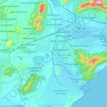
Name: Gajuwaka topographic map, elevation, terrain.
Location: Gajuwaka, Visakhapatnam District, Andhra Pradesh, India (17.62820 83.11174 17.73397 83.29807)
Average elevation: 164 ft
Minimum elevation: -13 ft
Maximum elevation: 1,703 ft
Make a donation
Gear up for your next adventure:
As an Amazon Associate, this site earns from qualifying purchases at no extra cost to you.
Other topographic maps
Click on a map to view its topography, its elevation and its terrain.
Guntakal
India > Andhra Pradesh > Guntakal
Guntakal is located at 15°10′N 77°23′E / 15.17°N 77.38°E / 15.17; 77.38. It has an average elevation of 432 metres (1,417 ft).
Average elevation: 1,460 ft
Vijayawada
Vijayawada lies on the banks of Krishna river, covered by hills and canals. and at an altitude of 11 m (36 ft) above sea level. Three canals originating from the north side of the Prakasam Barrage reservoir — Eluru, Bandar, and Ryves — flow through the city.
Average elevation: 118 ft
Make a donation
Gear up for your next adventure:
As an Amazon Associate, this site earns from qualifying purchases at no extra cost to you.
Make a donation
Gear up for your next adventure:
As an Amazon Associate, this site earns from qualifying purchases at no extra cost to you.
Make a donation
Gear up for your next adventure:
As an Amazon Associate, this site earns from qualifying purchases at no extra cost to you.
Make a donation
Gear up for your next adventure:
As an Amazon Associate, this site earns from qualifying purchases at no extra cost to you.
Make a donation
Gear up for your next adventure:
As an Amazon Associate, this site earns from qualifying purchases at no extra cost to you.
Machilipatnam
India > Andhra Pradesh > Machilipatnam > Machilipatnam
Machilipatnam city is at 16°10′N 81°08′E / 16.17°N 81.13°E / 16.17; 81.13 on the southeast coast of India and in the east coast of Andhra Pradesh. The city has an average elevation of 14 meters (45 feet).
Average elevation: 13 ft
Make a donation
Gear up for your next adventure:
As an Amazon Associate, this site earns from qualifying purchases at no extra cost to you.
Mangalagiri
India > Andhra Pradesh > Mangalagiri > Mangalagiri
Mangalagiri is located at 16°26′N 80°33′E / 16.43°N 80.55°E / 16.43; 80.55. It has an average elevation of 29.08 m (95.4 ft).It is located 26 kilometres (16 mi) north east of the district headquarters, Guntur, and just 10 km (6.2 mi) south west of Vijayawada and also 30 km (19 mi) to the north…
Average elevation: 95 ft
Make a donation
Gear up for your next adventure:
As an Amazon Associate, this site earns from qualifying purchases at no extra cost to you.
Make a donation
Gear up for your next adventure:
As an Amazon Associate, this site earns from qualifying purchases at no extra cost to you.
Make a donation
Gear up for your next adventure:
As an Amazon Associate, this site earns from qualifying purchases at no extra cost to you.