
Rømskog topographic map
Interactive map
Click on the map to display elevation.
About this map
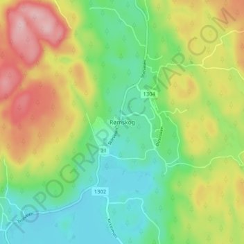
Name: Rømskog topographic map, elevation, terrain.
Location: Rømskog, Aurskog-Høland, Viken, 1950, Norway (59.72926 11.79286 59.76926 11.83286)
Average elevation: 686 ft
Minimum elevation: 440 ft
Maximum elevation: 1,066 ft
Other topographic maps
Click on a map to view its topography, its elevation and its terrain.
Engelsviken
Norway > Viken > Engelsviken
Engelsviken, Fredrikstad, Viken, 1628, Norway
Average elevation: 39 ft