
Temagami topographic map
Click on the map to display elevation.
About this map
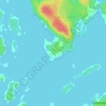
Name: Temagami topographic map, elevation, terrain.
Average elevation: 978 ft
Minimum elevation: 948 ft
Maximum elevation: 1,181 ft
Other topographic maps
Click on a map to view its topography, its elevation and its terrain.
Lake Nipissing
Canada > Ontario > Nipissing District
Lake Nipissing (/ˈnɪpəsɪŋ/; French: lac Nipissing, Ojibwe: Gichi-nibiinsing-zaaga’igan) is a lake in the Canadian province of Ontario. It has a surface area of 873.3 km2 (337.2 sq mi), a mean elevation of 196 m (643 ft) above sea level, and is located between the Ottawa River and Georgian Bay. Lake…
Average elevation: 892 ft
Papineau Lake
Canada > Ontario > Nipissing District > Papineau-Cameron Township
Average elevation: 1,096 ft
Lake Nosbonsing
Canada > Ontario > Nipissing District > East Ferris Township
Average elevation: 876 ft
North Bay
Canada > Ontario > Nipissing District
The climate in North Bay is common to most places in Northern Ontario. North Bay tends to be a less humid climate than that found in Southern Ontario due somewhat to the distance from the Great Lakes and less warm than some other locations in Northern Ontario due to cooling from Lake Nipissing. On May 31,…
Average elevation: 873 ft
Aylen Lake
Canada > Ontario > Nipissing District > South Algonquin Township
Average elevation: 1,184 ft
Kawawaymog Lake
Canada > Ontario > Nipissing District > Unorganized South Nipissing
Average elevation: 1,263 ft
Guthrie Lake
Canada > Ontario > Nipissing District > Unorganized South Nipissing
Average elevation: 981 ft
Rowan Lake
Canada > Ontario > Nipissing District > Unorganized South Nipissing
Average elevation: 922 ft
Temagami
Canada > Ontario > Nipissing District
Temagami provides rugged topography, which is excellent for canoeing and hiking. There are numerous viewpoints in the municipality, including High Rock and Caribou Mountain, which contains a 100 ft (30 m) fire tower on its summit.
Average elevation: 1,047 ft
Madawaska Highlands
Canada > Ontario > Nipissing District > Unorganized South Nipissing
Average elevation: 1,217 ft
Crotch Lake
Canada > Ontario > Nipissing District > Unorganized South Nipissing
Average elevation: 1,358 ft
Rutherglen
Canada > Ontario > Nipissing District > Bonfield Township > Rutherglen
Average elevation: 774 ft
Madawaska Highlands
Canada > Ontario > Nipissing District > South Algonquin Township
Average elevation: 1,450 ft
Ralph Bice Lake
Canada > Ontario > Nipissing District > Unorganized South Nipissing
Average elevation: 1,522 ft
Victoria Lake
Canada > Ontario > Nipissing District > South Algonquin Township
Average elevation: 1,335 ft
Wenona Lake
Canada > Ontario > Nipissing District > Unorganized South Nipissing
Average elevation: 1,532 ft
Moore Lake
Canada > Ontario > Nipissing District > South Algonquin Township
Average elevation: 1,329 ft
Cedar Lake
Canada > Ontario > Nipissing District > Unorganized South Nipissing
Average elevation: 1,214 ft
Bellwood
Canada > Ontario > Nipissing District > South Algonquin Township > Whitney
Average elevation: 1,345 ft
Moccasin Lake
Canada > Ontario > Nipissing District > Unorganized South Nipissing
Average elevation: 1,526 ft
Sunday Lake
Canada > Ontario > Nipissing District > Unorganized South Nipissing
Average elevation: 1,522 ft
Aylen Lake
Canada > Ontario > Nipissing District > South Algonquin Township
Average elevation: 1,214 ft
Mew Lake
Canada > Ontario > Nipissing District > Unorganized South Nipissing
Average elevation: 1,375 ft
Bissett Lake
Canada > Ontario > Nipissing District > Unorganized South Nipissing
Average elevation: 1,204 ft
Biggar Lake
Canada > Ontario > Nipissing District > Unorganized South Nipissing
Average elevation: 1,342 ft
Cedar Lake
Canada > Ontario > Nipissing District > Unorganized South Nipissing
Average elevation: 1,214 ft
Temagami
Canada > Ontario > Nipissing District
Temagami provides rugged topography, which is excellent for canoeing and hiking. There are numerous viewpoints in the municipality, including High Rock and Caribou Mountain, which contains a 100 ft (30 m) fire tower on its summit.
Average elevation: 1,047 ft
North Bay
Canada > Ontario > Nipissing District
The climate in North Bay is common to most places in Northern Ontario. North Bay tends to be a less humid climate than that found in Southern Ontario due somewhat to the distance from the Great Lakes and less warm than some other locations in Northern Ontario due to cooling from Lake Nipissing. On May 31,…
Average elevation: 873 ft
Pog Lake
Canada > Ontario > Nipissing District > Unorganized South Nipissing
Average elevation: 1,362 ft
North Bay
Canada > Ontario > Nipissing District
The climate in North Bay is common to most places in Northern Ontario. North Bay tends to be a less humid climate than that found in Southern Ontario due somewhat to the distance from the Great Lakes and less warm than some other locations in Northern Ontario due to cooling from Lake Nipissing. On May 31,…
Average elevation: 873 ft
Maple Leaf Lake
Canada > Ontario > Nipissing District > Unorganized South Nipissing
Average elevation: 1,673 ft
Sheriff Pond
Canada > Ontario > Nipissing District > Unorganized South Nipissing
Average elevation: 1,496 ft
Temagami
Canada > Ontario > Nipissing District
Temagami provides rugged topography, which is excellent for canoeing and hiking. There are numerous viewpoints in the municipality, including High Rock and Caribou Mountain, which contains a 100 ft (30 m) fire tower on its summit.
Average elevation: 1,047 ft
Radiant Lake
Canada > Ontario > Nipissing District > Unorganized South Nipissing
Average elevation: 968 ft
Bridle Lake
Canada > Ontario > Nipissing District > Unorganized South Nipissing
Average elevation: 1,411 ft