
Kitikmeot topographic map
Interactive map
Click on the map to display elevation.
About this map
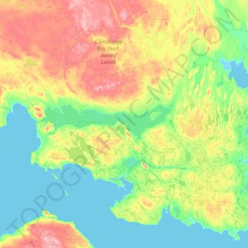
Name: Kitikmeot topographic map, elevation, terrain.
Location: Kitikmeot, Kitikmeot Region, Nunavut, Kanada (68.74084 -105.65764 70.02084 -104.37764)
Average elevation: 180 ft
Minimum elevation: -3 ft
Maximum elevation: 814 ft
Other topographic maps
Click on a map to view its topography, its elevation and its terrain.