
Wales Island topographic map
Interactive map
Click on the map to display elevation.
About this map
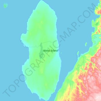
Name: Wales Island topographic map, elevation, terrain.
Location: Wales Island, Nunavut, Kanada (67.72450 -86.98250 68.30575 -86.34525)
Average elevation: 148 ft
Minimum elevation: -3 ft
Maximum elevation: 1,483 ft
Other topographic maps
Click on a map to view its topography, its elevation and its terrain.