
White Island topographic map
Interactive map
Click on the map to display elevation.
About this map
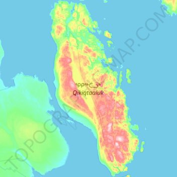
Name: White Island topographic map, elevation, terrain.
Location: White Island, Nunavut, Kanada (65.54033 -85.15877 66.03072 -84.55142)
Average elevation: 128 ft
Minimum elevation: -3 ft
Maximum elevation: 1,184 ft
Other topographic maps
Click on a map to view its topography, its elevation and its terrain.