
Nottingham Island topographic map
Interactive map
Click on the map to display elevation.
About this map
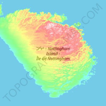
Name: Nottingham Island topographic map, elevation, terrain.
Location: Nottingham Island, Nunavut, Kanada (63.08868 -78.53536 63.48717 -77.48911)
Average elevation: 200 ft
Minimum elevation: -3 ft
Maximum elevation: 1,339 ft
Other topographic maps
Click on a map to view its topography, its elevation and its terrain.