Geolocate

Prest topographic map

Click on the map to display elevation.

About this map

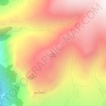
Name: Prest topographic map, elevation, terrain.

Location: Prest, Aurland, Vestland, 5745, Norway (60.93615 7.24094 60.93625 7.24104)

Average elevation: 3,996 ft

Minimum elevation: 1,490 ft

Maximum elevation: 5,528 ft

Other topographic maps

Click on a map to view its topography, its elevation and its terrain.

Tysnes

Norway > Vestland

Average elevation: 318 ft

Kvam herad

Norway > Vestland

Average elevation: 1,677 ft

Lærdal

Norway > Vestland

Average elevation: 3,789 ft

Austevoll

Norway > Vestland

Average elevation: 20 ft

Bjørnafjorden

Norway > Vestland

Average elevation: 30 ft

Høyanger

Norway > Vestland

Average elevation: 1,732 ft

Sveio

Norway > Vestland

Average elevation: 187 ft

Vik

Norway > Vestland

Average elevation: 2,425 ft

Voss

Norway > Vestland

Average elevation: 2,510 ft

Sogndal

Norway > Vestland

Average elevation: 2,379 ft

Gear up for your next adventure:

🔋Solar Power Banks - Keep your GPS and phone charged in remote wilderness areas
🧭GPS Watch Accessories - Bands and chargers for GPS watches
🎒Day Hiking Backpack - Lightweight backpack perfect for day trips and outdoor adventures
🌡️Handheld Weather Meters - Measure wind, temp, and pressure for safe mountain travel
🦺Reflective Outdoor Gear - Safety gear for low‑light conditions

As an Amazon Associate, this site earns from qualifying purchases at no extra cost to you.