
Hitra topographic map
Interactive map
Click on the map to display elevation.
About this map
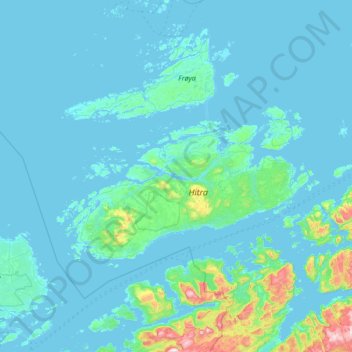
Name: Hitra topographic map, elevation, terrain.
Location: Hitra, Trøndelag, Norway (63.35941 8.10865 63.77365 9.44573)
Average elevation: 157 ft
Minimum elevation: -10 ft
Maximum elevation: 2,523 ft
Other topographic maps
Click on a map to view its topography, its elevation and its terrain.