
Støren topographic map
Interactive map
Click on the map to display elevation.
About this map
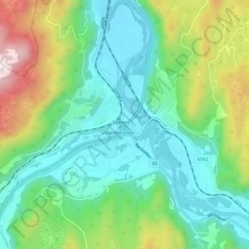
Name: Støren topographic map, elevation, terrain.
Location: Støren, Midtre Gauldal, Trøndelag, 7290, Norway (63.01535 10.27040 63.05535 10.31040)
Average elevation: 696 ft
Minimum elevation: 180 ft
Maximum elevation: 2,008 ft
Other topographic maps
Click on a map to view its topography, its elevation and its terrain.