
汉阴县 topographic map
Interactive map
Click on the map to display elevation.
About this map
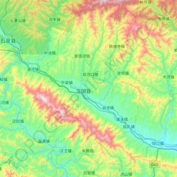
Name: 汉阴县 topographic map, elevation, terrain.
Location: 汉阴县, 安康市, 陕西省, 725100, 中国 (32.63983 108.18499 33.15638 108.73019)
Average elevation: 2,470 ft
Minimum elevation: 883 ft
Maximum elevation: 6,900 ft
Other topographic maps
Click on a map to view its topography, its elevation and its terrain.