
秦岭 topographic map
Interactive map
Click on the map to display elevation.
About this map
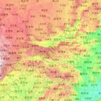
Name: 秦岭 topographic map, elevation, terrain.
Location: 秦岭, 宁陕县, 安康市, 陕西省, 中国 (32.45416 103.75763 35.03450 113.90624)
Average elevation: 3,346 ft
Minimum elevation: 59 ft
Maximum elevation: 15,922 ft
秦岭是横贯中国中部的一座褶皱山脉,西起甘肃临洮,东到河南省的崤山、熊耳山-嵩山和伏牛山地区,主体位于陕西省中南部,是陕西省关中地区与陕南地区的分界线,呈东西走向,长1600公里。宽200~300公里,海拔2000~3000米。
Other topographic maps
Click on a map to view its topography, its elevation and its terrain.