
泽州县 topographic map
Interactive map
Click on the map to display elevation.
About this map
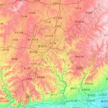
Name: 泽州县 topographic map, elevation, terrain.
Location: 泽州县, 晋城市, 山西省, 中国 (35.18904 112.54401 35.71395 113.22984)
Average elevation: 2,533 ft
Minimum elevation: 302 ft
Maximum elevation: 4,701 ft
Other topographic maps
Click on a map to view its topography, its elevation and its terrain.