Geolocate

沁河 topographic map

Interactive map

Click on the map to display elevation.

About this map

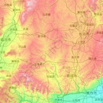
Name: 沁河 topographic map, elevation, terrain.

Location: 沁河, 沁水县, 晋城市, 山西省, 048203, 中国 (35.03724 112.22879 36.72831 113.11613)

Average elevation: 2,992 ft

Minimum elevation: 262 ft

Maximum elevation: 8,084 ft

Other topographic maps

Click on a map to view its topography, its elevation and its terrain.

白马寺山植物园

中国 > 山西省 > 晋城市

白马寺山植物园, 西上庄街道, 城区, 晋城市, 山西省, 中国

Average elevation: 2,621 ft

城区

中国 > 山西省 > 晋城市

城区, 晋城市, 山西省, 048000, 中国

Average elevation: 2,700 ft

金村镇

中国 > 山西省 > 晋城市

金村镇, 晋城市, 山西省, 中国

Average elevation: 2,500 ft

凤城镇

中国 > 山西省 > 晋城市

凤城镇, 晋城市, 山西省, 中国

Average elevation: 2,152 ft

七星公园

中国 > 山西省 > 晋城市 > 北街街道

七星公园, 北街街道, 城区, 晋城市, 山西省, 中国

Average elevation: 2,408 ft

陵川县

中国 > 山西省 > 晋城市

陵川县, 晋城市, 山西省, 中国

Average elevation: 3,638 ft

泽州县

中国 > 山西省 > 晋城市

泽州县, 晋城市, 山西省, 中国

Average elevation: 2,533 ft

晋城市

中国 > 山西省 > 晋城市

晋城市, 城区, 晋城市, 山西省, 048000, 中国

Average elevation: 2,671 ft

周村镇

中国 > 山西省 > 晋城市 > 周村镇

周村镇, 泽州县, 晋城市, 山西省, 中国

Average elevation: 2,375 ft