
Huaribamba topographic map
Click on the map to display elevation.
About this map
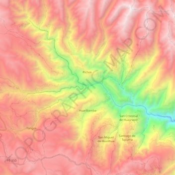
Name: Huaribamba topographic map, elevation, terrain.
Location: Huaribamba, Tayacaja, Huancavelica, Perú (-12.34210 -75.02768 -12.16491 -74.82502)
Average elevation: 11,936 ft
Minimum elevation: 6,391 ft
Maximum elevation: 15,761 ft
Other topographic maps
Click on a map to view its topography, its elevation and its terrain.
Villa Salvador
Perú > Huancavelica > Santiago de Quirahuara > Villa Salvador
Average elevation: 12,218 ft