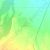
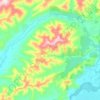
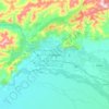
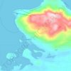
Circle topographic map
Click on the map to display elevation.
About this map

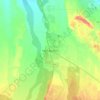
Name: Circle topographic map, elevation, terrain.
Location: Circle, Unorganized Borough, Alaska, 99733, United States (65.69080 -144.38284 65.90898 -144.02430)
Average elevation: 751 ft
Minimum elevation: 564 ft
Maximum elevation: 1,407 ft
Alaska trails, hiking, mountain biking, running and outdoor activities
Other topographic maps
Click on a map to view its topography, its elevation and its terrain.


Mount Hayes
United States > Alaska > Unorganized Borough
Mount Hayes is the highest mountain in the eastern Alaska Range, in the U.S. state of Alaska. Despite not being a fourteener, it is one of the largest peaks in the United States in terms of rise above local terrain. For example, the Northeast Face rises 8,000 feet (2,440 m) in approximately 2 miles (3.2 km).…
Average elevation: 10,614 ft








Atqasuk
United States > Alaska > North Slope
Atqasuk has one airport, Atqasuk Edward Burnell Sr. Memorial Airport, that is uncontrolled and has a single 4,370-by-90-foot (1,332 by 27 m) runway at an elevation of 96 feet (29 m).
Average elevation: 66 ft


Freshwater Bay
United States > Alaska > Unorganized Borough > Freshwater Bay
Average elevation: 148 ft
Chatanika
United States > Alaska > Fairbanks North Star
Located 2 miles (3.2 km) east of the confluence of Cleary Creek and the Chatanika River, Chatanika lies 20 miles (32 km) northeast of Fairbanks. Its altitude is 896 feet (273 m).
Average elevation: 892 ft










Akiak
United States > Alaska > Unorganized Borough
The airport has a gravel runway in good condition, measuring 3,196 feet (974 m) long by 75 feet (23 m) wide, at an elevation of 30 feet (9.1 m). The strip provides chartered or private air access year-round. Arctic Circle Air Service, Grant Aviation, and Hageland Aviation offer passenger flight service. Snow…
Average elevation: 16 ft
Paxson
United States > Alaska > Unorganized Borough
Paxson has a continental subarctic climate (Köppen Dfc), closely bordering on an alpine climate (Köppen ET) due to its high elevation and northerly latitude, with only one month above the 50 degree isotherm.
Average elevation: 3,330 ft
Homer
United States > Alaska > Kenai Peninsula > Homer
Some birds seen during the spring migration and the festival include horned puffins, sandhill cranes, and arctic terns. Arctic Terns are famous for flying the longest distance of any migrating bird. Many of the birds seen during the festival can be identified with the help of published guides that categorize…
Average elevation: 348 ft