
Make a donation
Gear up for your next adventure:
As an Amazon Associate, this site earns from qualifying purchases at no extra cost to you.
Bald Mountain topographic map
Click on the map to display elevation.
Make a donation
Gear up for your next adventure:
As an Amazon Associate, this site earns from qualifying purchases at no extra cost to you.
About this map
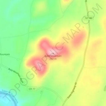
Name: Bald Mountain topographic map, elevation, terrain.
Average elevation: 423 ft
Minimum elevation: 135 ft
Maximum elevation: 764 ft
New York trails, hiking, mountain biking, running and outdoor activities
Make a donation
Gear up for your next adventure:
As an Amazon Associate, this site earns from qualifying purchases at no extra cost to you.
Other topographic maps
Click on a map to view its topography, its elevation and its terrain.
Washington Heights
United States > New York > New York
Because of their abrupt, hilly topography, pedestrian navigation in Upper Manhattan is facilitated by many step streets. The longest of these in Washington Heights, at approximately 130 stairs and with an elevation gain of approximately 65 feet, connects Fort Washington Avenue and Overlook Terrace at 187th…
Average elevation: 82 ft
Catskill Park
New York's wilderness areas must be composed of 10,000 acres (4,000 ha; 40 km2) of contiguous land, twice the federal standard. Land is to be left as "untrammeled by man" and as close to its natural state as possible, offering outstanding opportunities for solitude. No artificially-powered devices are…
Average elevation: 1,644 ft
Make a donation
Gear up for your next adventure:
As an Amazon Associate, this site earns from qualifying purchases at no extra cost to you.
DeKalb Junction
United States > New York > Saint Lawrence County > Town of De Kalb
Average elevation: 430 ft
Make a donation
Gear up for your next adventure:
As an Amazon Associate, this site earns from qualifying purchases at no extra cost to you.
Genesee River
Only a small creek (Irondequoit Creek) flows in what is left of this large paleogeologic valley. The area of the lower river was also affected. Since the earth rebounded from the melting glaciers more rapidly in Canada than in New York, water from Lake Ontario was spilled over New York due to its lower…
Average elevation: 1,302 ft
Make a donation
Gear up for your next adventure:
As an Amazon Associate, this site earns from qualifying purchases at no extra cost to you.
Make a donation
Gear up for your next adventure:
As an Amazon Associate, this site earns from qualifying purchases at no extra cost to you.
Erie Canal
United States > New York > Erie County > City of Tonawanda
The construction of the Erie Canal was a landmark civil engineering achievement in the early history of the United States. When built, the 363-mile (584 km) canal was the second-longest in the world (after the Grand Canal in China). Initially 40 feet (12 m) wide and 4 feet (1.2 m) deep, the canal was expanded…
Average elevation: 581 ft
Make a donation
Gear up for your next adventure:
As an Amazon Associate, this site earns from qualifying purchases at no extra cost to you.
Make a donation
Gear up for your next adventure:
As an Amazon Associate, this site earns from qualifying purchases at no extra cost to you.
Village of Geneseo
United States > New York > Livingston County > Town of Geneseo
Average elevation: 715 ft
Make a donation
Gear up for your next adventure:
As an Amazon Associate, this site earns from qualifying purchases at no extra cost to you.
Cayuga Lake
United States > New York > Cayuga County > Village of Union Springs
Average elevation: 866 ft
Make a donation
Gear up for your next adventure:
As an Amazon Associate, this site earns from qualifying purchases at no extra cost to you.
Make a donation
Gear up for your next adventure:
As an Amazon Associate, this site earns from qualifying purchases at no extra cost to you.
Make a donation
Gear up for your next adventure:
As an Amazon Associate, this site earns from qualifying purchases at no extra cost to you.
Slide Mountain Wilderness
United States > New York > Ulster County > Town of Shandaken > Town of Denning
Within its boundaries lie 10 of the 35 Catskill High Peaks, including the highest Catskill peak, Slide, 4,180 feet (1277 m) of elevation; and lowest, Rocky.
Average elevation: 1,916 ft
Village of Ravena
United States > New York > Albany County > Town of Coeymans
Average elevation: 253 ft
Make a donation
Gear up for your next adventure:
As an Amazon Associate, this site earns from qualifying purchases at no extra cost to you.
Barrett Pond
United States > New York > Columbia County > Town of Austerlitz
Average elevation: 1,512 ft
Make a donation
Gear up for your next adventure:
As an Amazon Associate, this site earns from qualifying purchases at no extra cost to you.
Village Green
United States > New York > Onondaga County > Town of Van Buren
Average elevation: 427 ft
Make a donation
Gear up for your next adventure:
As an Amazon Associate, this site earns from qualifying purchases at no extra cost to you.
Au Sable Forks
United States > New York > Clinton County > Town of Black Brook
Average elevation: 781 ft
Make a donation
Gear up for your next adventure:
As an Amazon Associate, this site earns from qualifying purchases at no extra cost to you.
Make a donation
Gear up for your next adventure:
As an Amazon Associate, this site earns from qualifying purchases at no extra cost to you.
Great Sacandaga Lake
United States > New York > Fulton County > Town of Hadley
Average elevation: 1,214 ft
Village of Warwick
United States > New York > Orange County > Town of Warwick
Average elevation: 614 ft
Make a donation
Gear up for your next adventure:
As an Amazon Associate, this site earns from qualifying purchases at no extra cost to you.
Make a donation
Gear up for your next adventure:
As an Amazon Associate, this site earns from qualifying purchases at no extra cost to you.
Cedar River
United States > New York > Hamilton County > Town of Lake Pleasant
Average elevation: 2,503 ft
Star Lake
United States > New York > Saint Lawrence County > Town of Fine > Star Lake
Average elevation: 1,453 ft
Make a donation
Gear up for your next adventure:
As an Amazon Associate, this site earns from qualifying purchases at no extra cost to you.
Boonville Forest Preserve Detached Parcel
United States > New York > Lewis County
Average elevation: 1,165 ft
Malden West Camp Fire District Map
United States > New York > Greene County > Saugerties
Average elevation: 161 ft
Make a donation
Gear up for your next adventure:
As an Amazon Associate, this site earns from qualifying purchases at no extra cost to you.
Make a donation
Gear up for your next adventure:
As an Amazon Associate, this site earns from qualifying purchases at no extra cost to you.
Make a donation
Gear up for your next adventure:
As an Amazon Associate, this site earns from qualifying purchases at no extra cost to you.
Town of Hammond
United States > New York > Saint Lawrence County > Town of Hammond
The Village of Hammond is located at 44°26′56″N 75°41′39″W / 44.44889°N 75.69417°W / 44.44889; -75.69417Coordinates: 44°26′56″N 75°41′39″W / 44.44889°N 75.69417°W / 44.44889; -75.69417. The elevation is 358 feet (109 m).
Average elevation: 325 ft
Owasco Lake
United States > New York > Cayuga County > Town of Niles
Owasco Lake is 11.1 miles (17.9 km) long, with a maximum width of 1.3 miles (2.1 km). The lake reaches a maximum depth of 177 feet (54 m) and has a surface elevation of 712 feet (217 m) above sea level, controlled by a dam on the lake's outlet. The lake has a volume of 212 billion US gallons (800,000,000 m3),…
Average elevation: 1,001 ft
Sacandaga Lake
United States > New York > Hamilton County > Town of Lake Pleasant
Average elevation: 1,742 ft
Make a donation
Gear up for your next adventure:
As an Amazon Associate, this site earns from qualifying purchases at no extra cost to you.
Make a donation
Gear up for your next adventure:
As an Amazon Associate, this site earns from qualifying purchases at no extra cost to you.
John Boyd Thacher State Park
United States > New York > Albany County > Town of New Scotland
The escarpment features rocks of the Upper Silurian and Upper and Middle Ordovician ages resting below the Devonian rocks. At the base of the escarpment, the Schenectady beds are visible. The Rondout "waterlime" or dolomite overlies the Schenectady beds and is most pronounced below Minelot Falls. The…
Average elevation: 860 ft
Make a donation
Gear up for your next adventure:
As an Amazon Associate, this site earns from qualifying purchases at no extra cost to you.
Sleepy Hollow Lake
United States > New York > Greene County > Sleepy Hollow Lake
Average elevation: 92 ft
Salt Point
United States > New York > Dutchess County > Town of Pleasant Valley
Average elevation: 318 ft
Make a donation
Gear up for your next adventure:
As an Amazon Associate, this site earns from qualifying purchases at no extra cost to you.