
平城区 topographic map
Interactive map
Click on the map to display elevation.
About this map
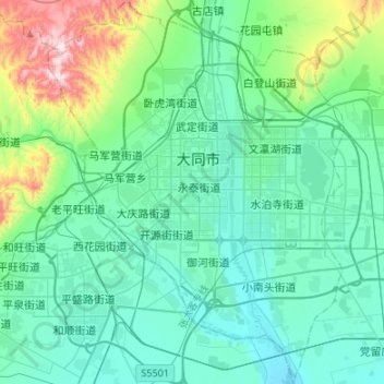
Name: 平城区 topographic map, elevation, terrain.
Location: 平城区, 大同市, 山西省, 中国 (39.97085 113.18984 40.17614 113.39693)
Average elevation: 3,606 ft
Minimum elevation: 3,281 ft
Maximum elevation: 5,102 ft
Other topographic maps
Click on a map to view its topography, its elevation and its terrain.