
云州区 topographic map
Interactive map
Click on the map to display elevation.
About this map
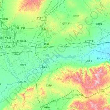
Name: 云州区 topographic map, elevation, terrain.
Location: 云州区, 大同市, 山西省, 中国 (39.70813 113.32176 40.25364 113.86336)
Average elevation: 3,983 ft
Minimum elevation: 2,858 ft
Maximum elevation: 7,920 ft
Other topographic maps
Click on a map to view its topography, its elevation and its terrain.