
背崩乡 topographic map
Interactive map
Click on the map to display elevation.
About this map
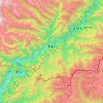
Name: 背崩乡 topographic map, elevation, terrain.
Location: 背崩乡, 墨脱县, 林芝市, 西藏自治区, 860000, 中国 (29.06834 94.73490 29.37290 95.26262)
Average elevation: 8,235 ft
Minimum elevation: 1,519 ft
Maximum elevation: 18,596 ft
Other topographic maps
Click on a map to view its topography, its elevation and its terrain.