
格当乡 topographic map
Interactive map
Click on the map to display elevation.
About this map
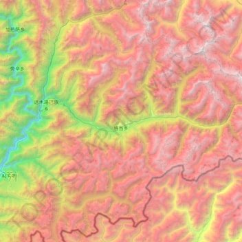
Name: 格当乡 topographic map, elevation, terrain.
Location: 格当乡, 墨脱县, 林芝市, 西藏自治区, 中国 (29.24786 95.42509 29.66925 96.09445)
Average elevation: 11,266 ft
Minimum elevation: 2,359 ft
Maximum elevation: 19,491 ft
格当乡是中国西藏自治区墨脱县下辖的一个乡,位于县境东北部,南毗印度实际控制区,2007年共有农业人口106户,588人,主要为藏族。全乡平均海拔约1900米,地势在县内乡镇中相对平坦,对外交通联系方面,冬季主要往来达木乡,夏季则主要往来波密县大兴乡。经济以农业为主,2007年农作物播种面积2657亩,主要种植青稞、小麦、玉米、蔓稼、黄豆和辣椒等,农田以常耕地为主。
Other topographic maps
Click on a map to view its topography, its elevation and its terrain.