Geolocate

Honea Path topographic map

Click on the map to display elevation.

About this map

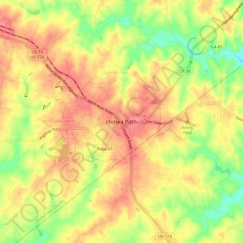
Name: Honea Path topographic map, elevation, terrain.

Location: Honea Path, Anderson County, South Carolina, 29654, United States (34.40650 -82.43151 34.48650 -82.35151)

Average elevation: 732 ft

Minimum elevation: 600 ft

Maximum elevation: 827 ft

Other topographic maps

Click on a map to view its topography, its elevation and its terrain.

Belton

United States > South Carolina > Anderson County

Average elevation: 843 ft

Pendleton

United States > South Carolina > Anderson County

Average elevation: 787 ft

Piedmont

United States > South Carolina > Anderson County

Average elevation: 843 ft

Piedmont

United States > South Carolina > Anderson County

Average elevation: 843 ft

Piedmont

United States > South Carolina > Anderson County

Average elevation: 843 ft

Pendleton

United States > South Carolina > Anderson County

Average elevation: 787 ft

Starr

United States > South Carolina > Anderson County

Average elevation: 745 ft

Pelzer

United States > South Carolina > Anderson County

Average elevation: 784 ft

Belton

United States > South Carolina > Anderson County

Average elevation: 843 ft

Gear up for your next adventure:

🛏️Cold Weather Sleeping Bag - Warm sleeping bag for cold conditions
🛰️Satellite Messengers - Emergency SOS and two-way messaging for off-grid adventures
🧼Biodegradable Camping Soap - Eco‑friendly soap for outdoor hygiene
🧭Orienteering Set - Complete compass and map reading kit
😴Insulated Sleeping Pads - Compact and warm pads for high-elevation camping

As an Amazon Associate, this site earns from qualifying purchases at no extra cost to you.