
巴嘎乡 topographic map
Interactive map
Click on the map to display elevation.
About this map
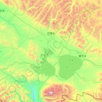
Name: 巴嘎乡 topographic map, elevation, terrain.
Location: 巴嘎乡, 普兰县, 阿里地区, 西藏自治区, 中国 (30.42061 80.54186 31.21109 81.60714)
Average elevation: 16,430 ft
Minimum elevation: 13,235 ft
Maximum elevation: 25,016 ft
Other topographic maps
Click on a map to view its topography, its elevation and its terrain.