Geolocate

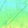
Marley topographic map

Click on the map to display elevation.

About this map

Name: Marley topographic map, elevation, terrain.

Location: Marley, Will County, Illinois, 60448, United States (41.52864 -87.94561 41.56864 -87.90561)

Average elevation: 702 ft

Minimum elevation: 640 ft

Maximum elevation: 771 ft

Will County trails, hiking, mountain biking, running and outdoor activities

Other topographic maps

Click on a map to view its topography, its elevation and its terrain.

Lockport

United States > Illinois > Will County

Average elevation: 650 ft

New Lenox

United States > Illinois > Will County

New Lenox features the Sanctuary Golf Course. Bordering the west end of New Lenox and Joliet is Woodruff Golf Course. Opened in 1926, Woodruff is a course with sweeping elevation changes and small greens.

Average elevation: 686 ft

Joliet

United States > Illinois > Will County

Average elevation: 640 ft

Mokena

United States > Illinois > Will County

Average elevation: 715 ft

Bolingbrook

United States > Illinois > Will County

Average elevation: 679 ft

Plainfield

United States > Illinois > Will County

Like its namesake, Plainfield's topography is generally flat. Thousands of years ago, land in greater Plainfield used to be part of the bed of proglacial Lake Wauponsee. However, the lake did not hold up long, and eventually drained into the Illinois River valley. The lake left behind a very flat landscape.…

Average elevation: 636 ft

Braidwood

United States > Illinois > Will County

Average elevation: 574 ft

Crete

United States > Illinois > Will County

Average elevation: 735 ft

Frankfort

United States > Illinois > Will County

Average elevation: 738 ft

Crest Hill

United States > Illinois > Will County

Average elevation: 620 ft

Monee

United States > Illinois > Will County

Average elevation: 784 ft

Homer Glen

United States > Illinois > Will County

Average elevation: 725 ft

Elwood

United States > Illinois > Will County

Average elevation: 620 ft

Channahon

United States > Illinois > Will County

Average elevation: 561 ft

University Park

United States > Illinois > Will County

Average elevation: 751 ft

Shorewood

United States > Illinois > Will County

Average elevation: 600 ft

Romeoville

United States > Illinois > Will County

Average elevation: 643 ft

Joliet

United States > Illinois > Will County

Average elevation: 640 ft

Joliet

United States > Illinois > Will County

Average elevation: 640 ft

Elwood

United States > Illinois > Will County

Average elevation: 620 ft

University Park

United States > Illinois > Will County

Average elevation: 751 ft

Lockport

United States > Illinois > Will County

Average elevation: 650 ft

Elwood

United States > Illinois > Will County

Average elevation: 620 ft

Mokena

United States > Illinois > Will County

Average elevation: 715 ft

Frankfort

United States > Illinois > Will County

Average elevation: 738 ft

Romeoville

United States > Illinois > Will County

Average elevation: 643 ft

Crete

United States > Illinois > Will County

Average elevation: 735 ft

Channahon

United States > Illinois > Will County

Average elevation: 561 ft

Puddle Pond

United States > Illinois > Will County > Plainfield

Average elevation: 614 ft

Peotone

United States > Illinois > Will County

Average elevation: 705 ft

Braidwood

United States > Illinois > Will County

Average elevation: 574 ft

Wilmington

United States > Illinois > Will County

Average elevation: 574 ft

Braidwood

United States > Illinois > Will County

Average elevation: 574 ft

Elwood

United States > Illinois > Will County

Average elevation: 620 ft

Homer Glen

United States > Illinois > Will County

Average elevation: 725 ft

Shorewood

United States > Illinois > Will County

Average elevation: 600 ft

Crete

United States > Illinois > Will County

Average elevation: 735 ft

Channahon

United States > Illinois > Will County

Average elevation: 561 ft

New Lenox

United States > Illinois > Will County

New Lenox features the Sanctuary Golf Course. Bordering the west end of New Lenox and Joliet is Woodruff Golf Course. Opened in 1926, Woodruff is a course with sweeping elevation changes and small greens.

Average elevation: 686 ft

Gear up for your next adventure:

🛡️Insect Repellent - Protection against bugs during outdoor activities
🧭Hiking Compass - Precision compass for reliable navigation in the wilderness
🌡️Portable Weather Meter - Track weather conditions on the trail
⛺Backpacking Tent - Lightweight and durable tent for multi‑day hikes
🥾Women's Hiking Boots - Top-rated trail boots with ankle support and superior grip

As an Amazon Associate, this site earns from qualifying purchases at no extra cost to you.