
富乐社区 topographic map
Interactive map
Click on the map to display elevation.
About this map
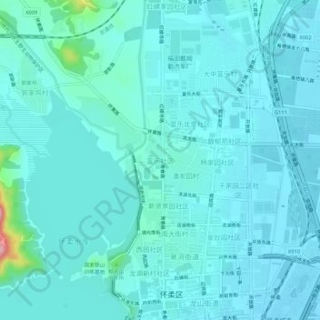
Name: 富乐社区 topographic map, elevation, terrain.
Location: 富乐社区, 怀柔区, 北京市, 101422, 中国 (40.31218 116.60419 40.35218 116.64419)
Average elevation: 197 ft
Minimum elevation: 141 ft
Maximum elevation: 633 ft
Other topographic maps
Click on a map to view its topography, its elevation and its terrain.