
Bagdad topographic map
Click on the map to display elevation.
About this map
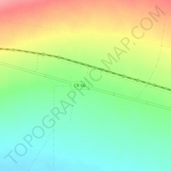
Name: Bagdad topographic map, elevation, terrain.
Location: Bagdad, San Bernardino County, California, United States (34.57293 -115.88557 34.59293 -115.86557)
Average elevation: 774 ft
Minimum elevation: 650 ft
Maximum elevation: 951 ft
California trails, hiking, mountain biking, running and outdoor activities
Other topographic maps
Click on a map to view its topography, its elevation and its terrain.
Big Bear Lake
United States > California > San Bernardino County > Big Bear Lake
At a surface elevation of 6,743 ft (2,055 m) above sea level, it has an east-west length of approximately seven miles (11 km) and is approximately 2.5 miles (4.0 km) at its widest measurement, though the lake's width mostly averages a little more than 1⁄2 mi (0.8 km). These approximations are based on the…
Average elevation: 7,247 ft
Sebastopol
United States > California > Sonoma County
Sebastopol's elevation is 65 to 250 feet (20 to 76 meters) above sea level. Its downtown is at the intersection of State Route 12 and State Route 116 (Gravenstein Highway), approximately 9 mi (14 km) west of U.S. Route 101.
Average elevation: 226 ft
Twentynine Palms
United States > California > Twentynine Palms
According to the United States Census Bureau, the city has a total area of 59.1 square miles (153 km2), all land. The city is at an elevation of 1,988 feet (606 m). The Marine Corps Air Ground Combat Center Twentynine Palms is located there.
Average elevation: 2,264 ft
Orange County Great Park
United States > California > Orange County > Irvine
Average elevation: 381 ft
Idyllwild-Pine Cove
United States > California > Riverside County
"Mile-high Idyllwild" is a mountain resort about one-mile (1,600 m) in altitude. Idyllwild is flanked by two large rock formations, Tahquitz Peak and Suicide Rock (also known as Lily Rock), which are famous in Southern California rock-climbing circles. It offers no skiing, so "the Hill" has been minimally…
Average elevation: 5,728 ft
Palm Springs
United States > California > Riverside County
Palm Springs, located in the Coachella Valley, is characterized by striking topography shaped by both the Colorado Desert and surrounding mountain ranges. The city lies at an average elevation of around 480 feet (146 meters) above sea level. To the west, the San Bernardino Mountains rise dramatically, with…
Average elevation: 2,818 ft
Mono Lake
United States > California > Mono County
Lake Russell was the prehistoric predecessor to Mono Lake, during the Pleistocene. Its shoreline reached the modern-day elevation of 7,480 feet (2,280 m), about 1,100 feet (330 m) higher than the present-day lake. As of 1.6 million years ago, Lake Russell discharged to the northeast, into the Walker River…
Average elevation: 6,588 ft
Thousand Oaks
United States > California > Ventura County > Thousand Oaks
The northern parts consist of mountainous terrain in the Simi Hills, Conejo Mountains and Mount Clef Ridge. Narrow canyons such as Hill Canyon cut through the steeper mountainous areas. Conejo Mountain and Conejo Grade are found in westernmost Newbury Park, while the southernmost parts of Thousand Oaks are…
Average elevation: 994 ft
Lancaster
United States > California > Lancaster
According to the United States Census Bureau, the city has a total area of 94.5 square miles (245 km2), of which 94.3 square miles (244 km2) is land and 0.3 square miles (0.78 km2) (0.29%) is water. Lancaster's elevation is 2,350 feet (720 m) above sea level on a high, flat valley surrounded by pristine…
Average elevation: 2,582 ft
Horseshoe Lake
United States > California > Alameda County > Fremont > Eberly
Average elevation: 75 ft
Crystal Cove State Park
United States > California > Orange County > Newport Beach
Average elevation: 509 ft
Big Bear City
United States > California > San Bernardino County > Big Bear City
It is estimated that the Serrano natives first settled in Big Bear between 1,500 and 2,000 years ago. The Serranos had both winter and summer settlements throughout the area. While their winter village was located in Lucerne Valley, they relocated to villages in the San Bernardino mountains during summer, as…
Average elevation: 7,070 ft
Weldon
United States > California > Kern County
Weldon is a census-designated place (CDP) in Kern County, California, United States. It sits at the southeast tip of Lake Isabella. Weldon is located 9 miles (14 km) east-southeast of Wofford Heights, at an elevation of 2,654 feet (809 m). The population was 2,642 at the 2010 census, up from 2,387 at the 2000…
Average elevation: 3,379 ft
Sierra National Forest
Sierra National Forest covers, in descending order of forestland area, the eastern portions of Fresno, Madera, and Mariposa counties, adjacent to the southern part of Yosemite National Park. It includes more than 1,300,000 acres (2,000 sq mi; 5,300 km2), at altitudes ranging from 900 to 13,986 feet (274 to…
Average elevation: 6,519 ft
Pine Valley
According to the United States Geological Survey, Pine Valley is located 3,736 feet (1,139 m) above sea level, at 32°49′17″N 116°31′45″W / 32.82139°N 116.52917°W / 32.82139; -116.52917. Interstate 8 passes east-to-west along the southern border of Pine Valley. It crosses the Pine Valley…
Average elevation: 4,236 ft
Mojave National Preserve
Climate in the preserve varies greatly. Summer temperatures average 90 °F (32 °C), with highs exceeding 105 °F (41 °C). Elevations in the preserve range from 7,929 feet (2,417 m) at Clark Mountain to 880 feet (270 m) near Baker. Annual precipitation varies from 3.37 inches (86 mm) near Baker, to almost 9…
Average elevation: 3,146 ft
Lassen National Forest
An ancient volcano, known as Mount Tehama is believed to have been much larger and taller than Lassen Peak. Its erosion is responsible for the topography of the national forest and the national park: a volcanic rim, with elevations beginning at 6,000 feet (1,800 m) above sea level.
Average elevation: 4,895 ft
Anza-Borrego Desert State Park
Anza-Borrego Desert State Park lies in a unique geologic setting along the western margin of the Salton Trough. This major topographic depression with the Salton Sink having elevations of 200 ft (61 m) below sea level, forms the northernmost end of an active rift valley and a geological continental plate…
Average elevation: 1,988 ft
Los Padres National Forest
Los Padres National Forest is a United States national forest in southern and central California. Administered by the United States Forest Service, Los Padres includes most of the mountainous land along the California coast from Ventura to Monterey, extending inland. Elevations range from sea level to 8,847…
Average elevation: 1,460 ft
Independence
Independence is a census-designated place in Inyo County, California. Independence is located 41 miles (66 km) south-southeast of Bishop, at an elevation of 3930 feet (1198 m). It is the county seat of Inyo County, California. The population of this census-designated place was 669 at the 2010 census, up from…
Average elevation: 3,934 ft
Kern River
Despite its remote source, nearly all of the river is publicly accessible. The Kern River is particularly popular for wilderness hiking and whitewater rafting. The Upper Kern River is paralleled by trails to within a half-mile of its source (which lies at 13,600 feet (4,100 m)). Even with the presence of Lake…
Average elevation: 3,990 ft
Susanville
United States > California > Lassen County
Susanville (formerly known as Rooptown) is a town in and is the county seat of Lassen County, California, United States. Susanville is located on the Susan River in the southern part of the county, at an elevation of 4,186 feet (1,276 m). Its population is 16,728 as of the 2020 census, down from 17,947 from…
Average elevation: 4,413 ft
Fort Bragg
United States > California > Mendocino County
Fort Bragg, officially the City of Fort Bragg, is a city along the Pacific Coast of California along Shoreline Highway in Mendocino County. The city is 24 miles (39 km) west of Willits, at an elevation of 85 feet (26 m). Its population was 6,983 at the 2020 census.
Average elevation: 26 ft
Lake Tahoe Basin Management Unit
United States > California > El Dorado County
The Lake Tahoe Basin Management Unit is a United States National Forest that manages and protects public land surrounding Lake Tahoe and the Lake Tahoe Basin. Straddling the state borders of California and Nevada in the Sierra Nevada, the LTBMU encompasses 154,851 acres (626 km²) of National Forest system…
Average elevation: 6,499 ft
Gilroy
United States > California > Gilroy
Gilroy is located at 37°00′43″N 121°34′48″W / 37.012048°N 121.580080°W / 37.012048; -121.580080. It is approximately 26 km (16 mi) south of San Jose, California (Bailey Avenue (37.206770, -121.729150) to Monterey/Day Road (37.038210, -121.584480)) on U.S. Route 101 and 31 km (19 mi) inland…
Average elevation: 348 ft
Graton
United States > California > Sonoma County > Graton
Graton is located at the southeastern end of Green Valley, on the east bank of the seasonally flooding Atascadero Creek. The elevation ranges from approximately 85 feet (26 m) above Mean Sea Level (MSL) at Atascadero Creek to 213 feet (65 m) MSL at Oak Grove School.
Average elevation: 164 ft
Wrightwood
United States > California > Wrightwood
Wrightwood is a census-designated place in San Bernardino County, California. It sits at an elevation of 5,935 feet (1,809 m). The population was 4,525 at the 2010 census, up from the population of 3,837 at the 2000 census. Wrightwood is located 77 miles northeast of Los Angeles.
Average elevation: 6,247 ft
Hollywood Hills
United States > California > Los Angeles County > Los Angeles
Average elevation: 794 ft
Clear Lake
United States > California > Lake County > Lakeport
Clear Lake is 19 mi (31 km) by 8 mi (13 km) at its widest point, with a surface area of 43,785 acres (17,719 ha) and a 1,155,000 acre⋅ft (1,425,000 dam3) capacity. Average depth is 27 ft (8.2 m), maximum is 60 ft (18 m), lake elevation is 1,329 ft (405 m), and average water temperature is 40 °F (4 °C) in…
Average elevation: 1,742 ft
Squaw Valley
United States > California > Fresno County > Squaw Valley
Squaw Valley (formerly, Squawvalley) is a census-designated place located in Fresno County, California, in the United States. As of the 2010 census, the CDP had a total population of 3,162, up from 2,691 at the 2000 census. Despite the similar name, it is not the location of Squaw Valley Ski Resort or the 1960…
Average elevation: 1,827 ft
Yucca Valley
United States > California > San Bernardino County
Yucca Valley lies in the middle of the Morongo Basin at a base elevation of 3,300 feet. Joshua Tree National Park is adjacent to its southern border.
Average elevation: 3,629 ft
Russian River
United States > California > Mendocino County > Redwood Valley
Average elevation: 1,404 ft
San Juan Bautista
United States > California > San Benito County
In June 1904, early aviation pioneer John J. Montgomery made a series of successful test flights using his tandem-wing glider in San Juan. This was a prototype to his 1905 gliders that were used to make the first successful high-altitude flights in heavier-than-air flying machines in the world.
Average elevation: 236 ft
Rail Road Flat
United States > California > Calaveras County
This historic mining town, elevation 2,600 feet (788 m), was named after primitive mule-drawn ore cars used here. There was never actually a railroad here. The town was established in 1849. It was the site of an Indian council as well as the center of rich placer and quartz mining. Its largest producer was the…
Average elevation: 2,726 ft
Lake of the Pines
United States > California > Nevada County
Lake of the Pines is commonly associated with a gated residential community which surrounds a reservoir, also named Lake of the Pines. The reservoir was created by damming Magnolia Creek, in the Bear River watershed, and it has a maximum elevation of 459 m (1507 ft). The gated community contains a golf course…
Average elevation: 1,581 ft
SoCal Sports Complex
United States > California > San Diego County > Oceanside
Average elevation: 200 ft
Sand to Snow National Monument
United States > California > San Bernardino County
Sand dunes are home to the endangered fringe-toed lizard at the lower elevation confluence of the Whitewater and San Gorgonio Rivers, while Desert bighorn sheep are found at higher elevations.
Average elevation: 4,669 ft
Bradley
United States > California > Monterey County
Bradley is an unincorporated community and census-designated place (CDP) in Monterey County, California, on the Salinas River 14 miles (23 km) south-southeast of San Ardo and 20 miles (32 km) north of Paso Robles. Bradley sits at an elevation of 548 feet (167 m). The population was 69 at the 2020 census, down…
Average elevation: 623 ft
Alta Sierra
United States > California > Nevada County
Alta Sierra was laid out by property developers in the 1960s. Alta Sierra is a golf course community, with homes built around the Alta Sierra Country Club, a semi-private 18 hole course built in 1964. The community has a member-owned airport with a 2800-foot runway. The community is located just east of…
Average elevation: 1,978 ft
Sierra Vista Open Space Preserve
United States > California > Santa Clara County > San Jose
Average elevation: 1,588 ft
Joseph D. Grant County Park
United States > California > Santa Clara County
Average elevation: 2,067 ft
Crescent City
United States > California > Del Norte County
The topography of the sea floor surrounding Crescent City has the effect of focusing tsunamis. According to researchers at Humboldt State University and the University of Southern California, the city experienced tsunami conditions 31 times between the years 1933 and 2008. Although many of these incidents were…
Average elevation: 102 ft
Mammoth Lakes
United States > California > Mammoth Lakes
Mammoth Lakes is a town in Mono County, California, the county's only incorporated community. It is located immediately to the east of Mammoth Mountain, at an elevation of 7,880 feet (2,400 m). As of the 2010 United States Census, the population was 8,234, reflecting a 16% increase from the 2000 Census.
Average elevation: 7,165 ft